INTRODUCTION
In the jungle of top ten travel lists, I thought long and hard of doing my own and now, here I go. But instead of a top ten list of attractions, I’m giving you my twelve favourite regions of Bangkok to explore. It is a kind of mothership article for bangkokvanguards because these are twelve unique heritage landscape that I’m going to focus my explorations on in the months and years ahead. In the process, I’m going to update this blog by linking additional stories and guides of the region’s people, their communities, neighbourhoods and heritage. I want to experience Bangkok to the fullest and I want to help you to experience the same while supporting local economies. It’s also an attempt to document Bangkok’s diversity and the roles of Bangkok’s urban communities in the 21st century.

Megacity Bangkok. My goal: To map its distinct urban areas and the respective cultural heritage landscapes.
WHAT IS BANGKOK?
Before I moved from Germany to Thailand in 2003, I was an avid reader of all things Thailand and drew my own maps of Bangkok since I was a teenager. I have been exploring the city extensively for more than twelve years. I know full well, that to understand Bangkok is a life long, fun and eye-opening endeavour and I accept that will never fully understand all the aspects of Bangkok’s complex urban life. But what I do know, I’d like to share with you.
Throughout history, humans have created unique cities as they evolved, thrived and formed cities in relationship with their natural environment, beliefs and ambitions. Today, as cities are becoming more and more alike, we are searching for their unique DNA beneath the veneer of concrete, the modern gloss of skyscrapers and the allure of instant gratification.
To me, Bangkok is more than a city. It’s an urban organism that sprawls over 2,000 square kilometres across the marshy environment of the Chao Phraya river basin. It is home to approximately 20 million people and nearly 60 different ethnicities and their cultures. Throughout the past 240 years they have inscribed their stories and heritage into the geography and DNA of the city and created diverse urban cultural landscapes. If there’s one key aspect of Bangkok’s urban DNA, it’s diversity. This is aligned with the large number and different types of urban villages that have been around since before the first road was built.

Overview map of Bangkok’s heritage landscapes listed in this blog. P.s. CBD, residential suburbs, and industrial zones are not part.
WHERE AND HOW TO BEGIN TO EXPLORE BANGKOK?
Bangkok is a challenge for both visitors and writers given its size, complexity and unstructured nature. And I get it, most people want to keep it simple. What are the city’s main sights? Let’s get a cab there. Done!
So, I’m sorry for making it more complicated. And sorry, it’s indeed a long blog but it’s worth it. The areas in focus played an important role throughout history, from the founding of Bangkok in 1782 (and even before) until the era of industrialisation starting in the 1960’s. Inside Bangkok’s chaotic urban sprawl, I’m going to trace the city’s aquatic and agrarian roots as well as the dense Bladerunneresque neighbourhoods of post-modern Bangkok. Some areas are clearly defined neighbourhoods other areas may be more abstract as they encompass large areas containing a certain density of historic communities. They melt into and coexist like time bubbles in an ocean of more recent urban developments. These places may not always correspond to our romantic idea of Bangkok’s past but they all have evolved from the same roots – the Chao Phraya river and its vast network of waterways.
I will begin from the inner most sacred core of Bangkok to the outward fringes where the urban devours the rural and explore what local attractions, food, activities we can enjoy and how we can support local economies. This blog is only an overview, a brief introduction to each area and not a detailed guide. From here I want you to be able to go deeper into the areas of your interest as I link more content to it. It will link further down to the neighbourhood-, community and human level.
BUT WHAT IS A COMMUNITY?
The whole city started off with a Bang as the idea of village is encoded in the name. Bang means: village and Kok (from Makok) means wild plum. Hence, Bangkok – The village of the wild plum – the world’s biggest village.
Early travellers described Bangkok as the Venice of the East. The first recorded journey of missionaries mention numerous villages along the river and canals. They took notes of villages rooted in various ethnicities, crafts or religions, Bang Na, Bang Phli, Bang Yai, Bang Ramad and so on. Now, I drive on the elevated Bang Na Expressway where as 200 years ago, Bang Na was a village of bamboo sheds built in between Nipa palms along the marshy banks of the river. The names are still there, but what happened to the villages? Bangkok is still home to more than 2,100 urban and rural villages or communities (In Thai: Chumchon) and my goal is to take a closer look.

Once rural communities are now absorbed into the ever expanding city.

A water front community along the Khlong Phra Khanong canal.

Baan Bat, the producers of alms bowls. One of Bangkok’s last craft communities.
Communities or Chumchon have a negative stigma. They are often associated with slums and social ills. But that’s not the whole truth. The National Housing Authority classifies 140 communities as historic communities and these are divided in further categories such as urban, water front, shophouse, craft and market communities.
However, regardless their historic status, the government does not recognise them as part of Thailand’s heritage. The official heritage discourse usually revolves around ancient places and artefacts and those that belong to monarchy, religion and state. Local or vernacular heritage is not included in the official definition of heritage as of yet.
Hence, the stories of Bangkok’s cultural heritage landscapes is in its essence also the story of the city’s last historic villages. There is also a certain sense of urgency considering that there’s no official recognition or protection of vernacular heritage and the fact that Bangkok is not going to stop developing any time soon. So, lets begin.
THE RIVER, THE BIRTH OF THE CITY
The Chao Phraya River is the life-line of Bangkok and what deem Bangkok’s old town straddles along the banks and its vast canal network. I won’t include every single historically significant area and left out Wat Arun – Temple of Dawn and the surrounding areas among others. Beginning by the river, we start with Bangkok’s three most important historic centres and then move to a cross section of regions within Bangkok’s metropolitan area.
THE THREE HISTORIC CENTRES

These three centres are at the core of old Bangkok and boast the city’s most important cultural attractions. These centres had different functions and are very distinct from each other. They are the Thai Buddhist centre (Phra Nakhon), the Chinese port and merchant centre (Sampeng/Yaowarat) and the European centre (Bang Rak). These three areas are located on the eastern side of the River and grew especially in the late 19th century/ early 20th century. They are the best documented historic areas of the city and attract most of the tourists.
1. PHRA NAKHON
HOW IS PHRA NAKHON DIFFERENT?
As the political and spiritual nucleus of Thailand, Phra Nakhon earns the pole position among Bangkok’s historic districts. It’s the face of Bangkok that draws an endless stream of tour buses each day filled with tourists excited to snap photos of the Royal Palace, the Royal Temple Wat Phra Kaew and Wat Pho the Temple of the Reclining Buddha. But Phra Nakhon means more than just ticking off your bucketlist and here’s why.
Like the 49 other city districts, Phra Nakhon has various sub-neighbourhoods. The most important part of Phra Nakhon is called Rattanakosin which houses the main attractions. It is flanked by the river on one side and surrounded by a moat on the other to protect the royal palace. During the early days this area contained most of the capital’s palaces. Rattanakosin epitomises the splendour and national narrative of Thailand as a constitutional Buddhist monarchy and is best enjoyed when tourists have actually returned to their hotels.

Traditional neighbourhood in Phra Nakhon, specialised in the production and trade of Buddha images.

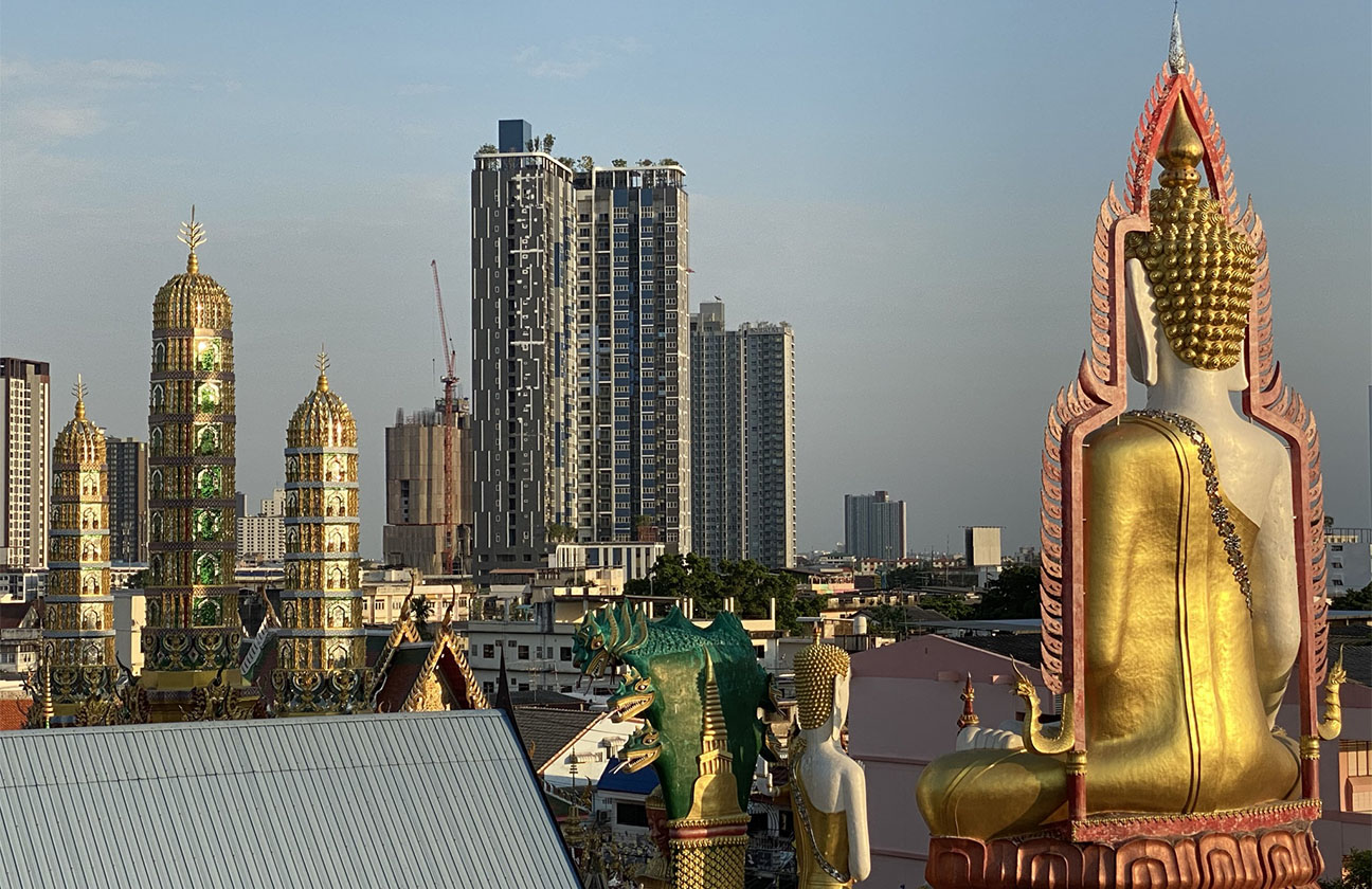
Downtown skyscraper looming in the distance and Giant Swing in the foreground.

Troksin Community. Rural feel inside small alleys. A journey back in time.
Beyond Rattanakosin’s protective moat lays the world of the commoners, the migrants and traders but also of Thai nobility. Most of the first roads were constructed here complete with stately Sino-Portuguese shophouses. Different ethnic minorities like the Mon, the Yuan, Khmer and Lao lived and worked in specialised communities and the moats also served as market centres. The link between Thai Buddhist temples and communities specialised in the production and trade of Buddhist items such as monk robes, alms bowls and Buddha images is the living cultural fabric and identity of Phra Nakhon. Add to that the large number of Buddhist temples and Buddhist centres and Phra Nakhon is undoubtedly the living hub for Theravada Buddhism in Thailand.
EXPLORE PHRA NAKHON
Exploring Phra Nakhon is a journey to Bangkok’s founding history and cultural origins. It is a journey through the lens of both, national heritage and local communal heritage. Visiting all the main temples alone, including Wat Arun across the river requires an entire day. If your time allows, go beyond Rattanakosin’s manicured and scared realms and brace for a beautiful panoply of Bangkok’s local food and culture. From vibrant market scenes to tranquil neighbourhoods. Building regulations curb large property development which gives Phra Nakhon a small town feel where temple spires still dominate the local skyline and of course it’s best enjoyed from one of the numerous cozy rooftop bars.

If it’s your first time to Bangkok, the main sights of Phra Nakhon are a must-see. Pick the timing of your visit to either early morning or later in the afternoon to avoid peak times for tour groups.
If you’re looking for bars, clubs, cheap accommodation and fried scorpions on a stick, Phra Nakhon boasts the world famous backpacker street: Khaosan Road. But if that’s not your thing, you’ll be forgiven. There are many local neighbourhoods waiting to be explored, such as Banglampoo, Phra Sumen, Samsen, Phraeng Phutton, Dinso Road, Pratu Phi, San Jao Po Sua, Sao Ching Cha and Fueang Nakhon. Worth mentioning are Nang Loeng and Thevet which are a short drive away but will please the foodie in you. What do these neighbourhoods offer if not fried scorpion and Falafel sandwiches? (P.s. Israeli food is my main draw for Khaosan Road)
Each of these neighbourhoods have their own history and trove of hidden gems. Graze your way through historic food markets, hole in the walls, roadside stalls, beautiful riverside diners or hunt for the popular spots such as Netflix / Michelin Star chef Je Fai. If that’s not enough, stroll the small romantic laneways and explore colourful markets, serene temples, stately heritage buildings, hidden cafes and bars, craft communities and beautiful boutique hotels. Will one day be enough?

Less touristy yet stunning.

Nang Loeng Market. Ready for some treats?
If you factor in the main sights, one day in the old town of Bangkok will not be enough. There is so much to see and to do. The best option is actually to book yourself a hotel there. This allows you to explore when the neighbourhood and morning markets spring to life and lines of monks make their rounds to collect alms. Phra Nakhon has a number of great hotels and hostels such as the Innspire Bangkok, Villa Mungkala, 1905 Heritage Corner, Baan Noppawong, Old Capital Bike Inn, Once Again Hostel and the Chakkrabongse Villa on the exclusive end.
Whenever you think to visit the Grand Palace or the Temple of the Reclining Buddha, remember that there’s a whole world to discover around the corner, where you can rest and recharge from the hustle and bustle of Bangkok’s top attractions.
2. CHINATOWN
HOW IS CHINATOWN DIFFERENT?
When Bangkok was founded in 1782, the construction of the royal palace complex forced a colony of Chinese traders to relocate to the marshes of Sampeng, a few kilometres southeast of Rattanakosin. That year marked the founding of what was to become the hub of the world’s largest Chinese diaspora and one of the greatest Chinatowns on the planet.
Sampeng became the kingdom’s main port and economic centre. After Sampeng’s port relocated to Khlong Toey in 1947, the neighbourhoods identity as a port remains to this day. Sampeng embodies the enterprising nature of Chinese migrants in Southeast Asia and represents a living link of Sino-Thai history. Chinatown and Phra Nakhon are linked through a network of markets straddling the river which I like to refer to as the market belt. Nowhere else in Bangkok does the relentless economic vigour coexist so closely to tranquil historic time bubbles.

Inside Chinatown’s maze of tiny alleys.

The contrast to the alleys is the frenzy of Chinatown’s Yaowarat Road.

Time travel. Classic shop house in Chinatown.
Chinatown was ranked among Asia’s most densely populated urban areas. Now it’s rather know for its densely packed side walks and folding tables as the disciples of street food turn Yaowarat Road into one of Asia’s most vibrant street food hubs. The energy and neon-lit streets shroud the grittiness of Bangkok’s first high-rises and postmodern shophouses. Chinatowns resistance to rapid modernisation earned it the unofficial title as Bangkok’s last authentic district. It fuses chaotic streets, vibrant markets, trendy historic neighbourhoods and religious and communal life into a complex amalgam of parallel universes that epitomise overseas Chinese enterprise, culture and civilisation.
EXPLORE CHINATOWN
Chinatown delivers some of the most poignant Bangkok memories but the difficulty is to grasp the scope of Chinatown. Where to begin amidst all the action around us? The classic Chinatown guides usually list Yaowarat Road at night, Wat Traimitr – the temple of the Golden Buddha, neighbouring Chinatown gate, Sampeng market, a Daoist shrine and maybe the temple with the crocodile. While these things range between awesome and ok, I still recommend a different approach to Chinatown. So, what do I suggest you to do?

Explore the small things. A staircase can lead to unexpected locations. Chinatown rewards the explorer.
Are you a curious person? Are you adventurous? Do you lean more towards the gritty side of a city rather than the shiny? If you ticked all of them with a yes, then Chinatown offers you the best playground for urban exploration since many of the timeless dimensions of Chinatown are hidden away from the main roads. While we understandably rely on our maps to feel safe when navigating the city, Chinatown works differently. It’s the incredible warren of tiny alleys and backstreets that is the main characteristic and yet it’s the least explored one. It’s legacy of the old days when these alleys connected Teochew, Hokkien, Hakka and other ethnic Chinese communities through the sprawling squalor of Bangkok’s port area. Thus, it’s more fun and interesting to navigate Chinatown through its alleys than its main roads.

The heritage and traditions are very much alive in Bangkok’s Chinese diaspora.

Exploring off the beaten track. Discovering the ancient homes of 19th century Chinese merchants which remain lost in time.

People and their heritage. Craft communities rooted to Daoism and Mahayana Buddhism.
If you have a zest for adventure and enough time to soak it all in, pick a start and an end point on a map, add a few cool spots along the way and hit the hidden road. A start point depends on your mode of arrival and the end points depends on what note you want to end your journey? Relaxed by the river or in an action packed street? There are too many places and options to suggest for the purpose of this article but if you need more inspiration and information, go a level deeper and click the link below when you can read about ten reasons why you should visit Chinatown.

Chinatown has both sides: high energy and adventure and peace and tranquility.
3. BANG RAK
WHAT’S UNIQUE ABOUT BANG RAK?
Bang Rak emerged as a third centre southeast of Phra Nakhon and Chinatown where Westerners were designated a tract of land which eventually grew to become the Western diplomatic and economic centre. By the late 19th century Bang Rak became the bridge head for Western capitalism and the free market ideology with major trade companies such as the East Asiatic Company, etc. setting up shop. As Bang Rak expanded, Christians missions and cathedrals began to sit next to Islamic Mosques, Buddhist temples and Cantonese shrines, turning Bang Rak into Bangkok’s a manifest of East meets West.

Remnants of the old Customs House under restoration.

Lebua State Tower towering over Bang Rak district. Enjoying a drink atop of the 247m tall building is part of Bangkok travel bucket list.

The Prince Theatre is the result of the conversion from the area’s first cinema, into a gambling and now cafe and hostel.
The lifeline of Bang Rak’s old quarters is the Chao Phraya river and Charoen Krung Road (Bangkok’s first modern road) running parallel to the river. The stark contrasts between Sino-Portuguese shophouses and the towering skyscrapers of 80’s/90’s economic boom times remind us of the area’s importance as a business hub. Judging by the frenetic inferno of clocked streets, crowded walkways and street vendors it still is full of economic vigour but it’s also facing demographic and economic challenges as most old town districts do.

The characteristic shophouse of Charoenkrung Road in Bang Rak

Holy Rosary Church, one of the oldest Christian inclaves in the city. Founded by Thai-Portuguese war refugees after the destruction of the Ayutthaya Kingdom.

Away from the hustle and bustle of Bang Rak’s main road, you can roam quite back alleys and explore local food and architecture.
EXPLORE BANG RAK
Bang Rak has it all. Five star hotels and luxury malls sit next to rickety bars while heritage buildings and repurposed warehouses provide scapes for cafes, galleries, cool restaurants and events. Grab specialties from a local street vendor or indulge a famous tea set at the historic authors lounge inside the Mandarin Oriental. Explore ethnically diverse communities, local markets, architecture and discover street art, hip cafes and top it off with a drink 247 meter above the ground. Bang Rak’s cultural diversity and the fusion of historic communities and upscale hospitality puts it on a unique map for fans of food, culture, history and awesome gastronomic experiences.

East Asiatic Building next to the Oriental Hotel.

Local mosque in a historic Islamic community in Bang Rak.
THONBURI – BANGKOK’S WESTSIDE

After introducingPhra Nakhon, Sampeng and Bang Rak on the east side, we are switching our attention to the west side of the river to Thonburi. Thonburi evokes two things in the Bangkokian’s mind. First is the historic importance as the former kingdom of King Taksin the Great (1767 – 1782) and second, it’s simply the other side of the river. Thonburi is one of many city districts, yet the entire western half of Bangkok is simply seen as Fang Thon (Fang = side, Thon = short for Thonburi).
During the time of King Taksin the great (1767 – 1782) Thonburi was the Thai capital. It was a vast riverine world dominated by marshes, thick tropical vegetation and waterways connecting the capital with other parts of the kingdom. The old waterways have always been important trade routes and ancient temples graced their banks since the Ayutthaya period (1350 – 1767). The site of today’s Grand Palace was a small but growing trade post run by Teochew Chinese. The removal of King Taksin in a palace coup marked the rise of a new dynasty. Bangkok across the river became the new capital and this marked the beginning of the decline of Thonburi.

Brave old world – Thonburi
Thonburi however retained some importance for its major transport routes to the west for defence and trade. The river delta also provided fertile land for agriculture. Thais, Teochew Chinese, Mon, Lao and other ethnicities settled in the sparsely populated and inhospitable marshes of the Chao Phraya, Tha Chin and Maeklong river basins. In the early 1800’s when Siam was still a closed off world, European voyagers noted numerous villages and temples along the waterways of Thonburi. These small hamlets were made from bamboo and atap and their names still linger on in the names of Bangkok’s districts and sub-districts.
Thonburi has come a long way ever since and my goal is to see what’s left of the former water world. For that we’re going to explore four regions on the westside: Khlong San, the west-bank of the river, across Sampeng and Bang Rak. The proximity to the river for trade makes it one of the more developed among Thonburi’s historic neighbourhoods. The Chao Phraya Oxbow which is the original flow of the Chao Phraya River. Beyond the oxbow and further out to the west along the old ‘water highways’ leading to neighbouring province. Bang Khun Thian toward the coastal region.
4. KHLONG SAN

WHAT MAKES KHLONG SAN DIFFERENT?
There was a time in Bangkok when the Teochew Chinese and Hokkien Chinese tried to avoid each other. The Teochew were established in Sampeng and the Hokkien for a time period settled on the other side of the river in Khlong San. It was Chinatown’s smaller sibling but like their Teochew kin, they were active in commerce and trade. Rice mills and the homes of wealthy Chinese tycoons lined the banks of Khlong San, which they do until this day.
When the Ratchawong Pier on the Sampeng riverfront launched the first steamship travel to Hong Kong and later Singapore, Khlong San’s Tha Din Daeng across the steamship terminal developed into a new centre for commuters and businesses. In the late 19th century, the area’s importance as a regional transport hub attracted international businesses and as well as Indian and Muslim migration. Khlong San became a multi-cultural trade hub with a diversified industry and production, linking the river and the Mahachai Railway Line. Khlong San was in a sense the synapse between rural production and urban markets.

Entry door into the ancient home of wealthy Chinese merchants.

Khlong San’s old school business. Relics of the early 1900’s era, still remain in small pockets along the river front.

Travellers enjoy the architectural preservation and reinvention of Khlong San’s old Chinese steamship terminal Khong 1919.
Fast forward a century later, the heritage of Khlong San’s economic heydays are still scattered around its various neighbourhoods with old factories, warehouses and labour barracks dating back to the second world war intermixing with 1970’s/1980’s working class neighbourhoods. The old and quaint feel makes Khlong San a popular movie shooting location such as James Bond Tomorrow Never dies.
EXPLORE KHLONG SAN
Khlong San can make for a decent urban hike full of discoveries and surprises. It is a district that is rapidly transforming into an international tourism hub with finely preserved architectural landmarks such as Lhong 1919, five-star hotels and the 2 billion USD riverside Icon Siam mega mall. Most of the rest of the riverine areas of Khlong San however have remained immune to grand-scale modernisation retained the vibes as Bangkok’s former multi-ethnic trading hub.

Bladerunner scene in Khlong San. The massive Icon Siam shopping mall placed in the midst of local neighbourhoods.

Classic street corner scene at night. Further away from the river toward Wong Wian Yai are neighbourhoods from the 1960/1970’s Bangkok side by side rural looking communities.

A cat in Khlong San’s old worker barracks.
Khlong San boasts a string of smaller neighbourhoods stretching along the river. These are best explored on foot, following the small alleys into an urban treasure hunt. Here you’ll find ethnically diverse communities rooted in various professions and industries, the knife makers, the leather makers and traditional herb traders. People live and work in an intricate jumble of temples, mosques, local markets, dilapidated warehouses, local shrines, street food markets and illegal liquor dens. Old buildings have been restored by locals into cozy cafes, for the locals as well as the intrepid explorer to take your Arabica break. Khlong San is perfect for those who see beauty in the ordinary, who are receptive for the unpretentious, stuck in time, day to day life. It adds a different urban experience to the portfolio of Bangkok’s neighbourhoods otherwise known mostly to local history nerds.

Group of cyclists exploring the old herbal warehouses along the river.

Local old school semi legal Ya Dong bars.
5. THE CHAO PHRAYA RIVER OXBOW

If the Chao Phraya was Bangkok’s historic, central transport and life artery, then the old Chao Phraya River Oxbow was its ring road. The name Chao Phraya River Oxbow refers to the shape of the original flow of the Chao Phraya River but is mainly used among conservationists, hence taxi drivers wouldn’t what you’re talking about.
The origins of the oxbow can be traced back to the times when Ayutthayan kings ordered the excavation of a short cut to shorten travel time from and to the Gulf of Thailand. Over the centuries this short cut grew wider and is seen by most people as the Chao Phraya River while the original flow of the river shrunk to what we refer to as the Bangkok Yai and Bangkok Noi canal.
It’s the River Oxbow and the vast canal system of Thonburi where we delve in nostalgia of bygone days when life by the canal was the everyday world. We think of what Bangkok used to be like before it was concreted over. A city of gardens and plantations where time was ticking slower than on the eastern side of the river. Today, Thonburi is still less affected by the rapid development of Bangkok but as mass transit systems expand, it poses both challenges and opportunities for the heritage of Thonburi.
WHAT IS UNIQUE ABOUT THE OLD CHAO PHRAYA RIVER OXBOW?
According to the National Housing Authority of Thailand there are 140 historic urban communities, which can be divided into five categories: urban villages, market communities, shop house communities, floating houses and waterfront communities. The old town areas in our previous four chapters mainly feature urban craft communities, market communities, and shop house communities. The communities of the Chao Phraya River Oxbow are among the most historic canal-based communities in Bangkok.

Khlong Bang Luang Community. The beautiful light wood structures offer a small wooden walkway for visitors to access the canal.

The heritage of merchant shophouses from the early 20th century in Talad Phlu on the southern end of the Oxbow.

The Southern part of the Oxbow was an important trade centre and railway transit point during the era of King Chulalongkorn and still offers famous eateries and beautiful Colonial architecture.
Thonburi’s canals embody the cultural landscape, livelihood and culture of the Chao Phraya River Valley. The River Oxbow is a very large area which consists of three canals in the south, centre and north. The unique aspect of the Oxbow is its unique historical relationship with the Rattanakosin Palace District. While Sampeng represents the heritage of Bangkok’s Chinese merchant class, the Oxbow was home to many of the low-ranking bureaucrats and civil servants who served the ruling class of Rattanakosin and that of King Taksin of Thonburi earlier.

Size does matter.

Inside a monk’s dream.

Spectacular landmarks in Thonburi
This unique cultural landscape reflects the life of the Rattanakosin era and is characterised by the many wooden houses along the canals which show us the patterns of early urban settlement. This waterborne landscape and lifestyle reveals not only the heritage of bureaucrats but also that of farmers and traders who settled near and around the large number of Thai Buddhist monasteries. Their houses can be distinguished by the different types of wooden structures that are still surviving to this day. Unfortunately however, rapid urbanisation has turned many of these ancient communities into shacks and slum-like dwellings. However. there are some local initiatives providing a glimmer of hope that travellers can experience as well.
Especially the southern half of the river oxbow has many places to explore off the beaten path. The banks are lined with temples at nearly every kilometre, numerous communities and historic market centres for trade as the canal also touches one of Thailand’s first railroads.
EXPLORE THE OLD CHAO PHRAYA RIVER OXBOW
The best way to experience the water world of Thonburi is on private boat tour. Alternatively, eScooter or a mountain bike tour, or a combo of boat & bike enables you to explore the entire stretch of the Oxbow which is otherwise too far for a walk. However, there are still incredible places along the canal that you can reach on foot from the Talad Phlu and Bang Wah Skytrain stations such as the Talad Phlu market, the Artist House at Khlong Bang Luang and Bangkok’s largest sitting Buddha of Wat Pak Nam Phasi Charoen which is a new, iconic landmark of Thonburi.

The most relaxing way to explore the canals.

Taking in the scenes of Thonburi’s landscape
The northern bend of the Oxbow also provides numerous places to explore Ban Bu community, the Royal Barges Museum and the Taling Chan Floating Market to name a few. Both the south and north bend of the oxbow served were part of the northwest and southwestern routes to the outlying provinces and regardless which canal you’re traveling on, the slow-paced Thonburian life will seem like an entirely different city to you.

The old roads of Bangkok, houses build along the canals.

Preserved structures along the canal as here in Khlong Bang Luang invite for a relaxing break.
6. GO WEST! BANGKOK’S ANCIENT WATER HIGHWAYS

Bangkok’s western canal network. The prime mode of transport in the old days.
Travel between Bangkok and the provinces during the 19th century, relied on a complex system of waterways and overland routes. Branching off from Chao Phraya River Oxbow were a number of canals leading north and south through the unpopulated and inhospitable marshes to Nakhon Chaisi and Mahachai in the Tha Chin River basin. From there, the route lead further to either Nakhon Pathom, Kanchanaburi, Ratchaburi, Samut Songkhram and Petchaburi.
Initially the canals served for the transport of troops to be quickly deployed in the western regions to defend against invasions from Myanmar. With increasing population and trade additional canals were constructed. Especially during the reign of King Chulalongkorn (1868-1910) which saw the transformation of Siam from a feudal society based on subsistence farming into a world exporter for rice, sugar and other agricultural products. Canals reached over a hundred kilometres into frontier regions and connected agricultural production with the global markets in Bangkok. At the same time new consumer products made their way from the capital into the new rural market centres.

Out of Bangkok. Is it still possible to travel by boat all the way into the provinces just as our ancestors did?
WHAT’S SPECIAL ABOUT BANGOK’S ANCIENT WATER HIGHWAYS?
When my grandmother (who is 94)was a young in the 1940’s, she traveled through the canals on a nearly 100km journey to transport coconuts from Samut Songkhram to Bangkok. Along the rivers and aquatic highways were many villages, temples and floating markets. They emerged and flourished in the late 19th century and well into the 20th century until the onset of Thailand’s rampant industrialisation of the 1960’s. This begs the question, how much of the city’s agricultural roots and heritage has survived? The exploration of Bangkok’s western water highways can give us glimpse into the life back then and how the regions of the Tha Chin and Maeklong River basins evolved.

Revitalising Bangkok’s ancient gardens

Fresh ingredients to make traditional snacks. Having fun learning from local wisdom along your journey.
EXPLORE THE ANCIENT WATER HIGHWAYS
Along the canals Bangkok stretches as a semi rural – semi urban organism into its environs. The southwestern region near the highway consists of semi-rural, semi-industrial area with never ending clusters of factories and living quarters of migrant workers while the canal have been somewhat spared from the development. One of the options along the southwest route for travellers is not via canals but through the Bangkok – Mahachai railroad. This slow-life journey takes you from Wong Wian Yai in Thonburi to Thailand’s largest seafood market in Mahachai. From there, cross the river and take a rickshaw to the Baan Laem trainstation to hop on the train to the infamous Maeklong Train market.

Far from Bangkok. Reaching Samut Songkhram’s Maeklong river basin.
There are many places scattered far and wide between between the Chao Phraya and the Tha Chin River. Some are known such as the Khlong Lat Mayom floating market, some area less known such as the Don Wai market as well as smaller community based agro tourism projects. It would be of benefit for local economies if combinations of water and overland routes could be developed. Especially along the scenic canals in the hinterlands that are fit for cycling. I hope travellers will be able to fully embrace the beauty of the region in eco-friendly ways instead of relying on road transport through urbanised areas only.

Instead of ticking off your bucket list, opt for slow travel with old and new friends and enjoy secluded spots along the riverine communities in central Thailand.

Riverside communities in central Thailand. At the capital’s door step yet a world away from Bangkok.
7. BANG KHUN THIAN SOUTH-WESTERN COASTAL REGION

Bang Khun Tian is Bangkok’s southwestern edge of Bangkok, bordering Samut Sakhon and touching the Gulf of Thailand. Bang Khun Thian was mentioned in the early 1800’s as it’s located along the southwest route along Sanam Chai canal. It was the most important linkage to the coastal market centres of Mahachai, Tha Chin and Maeklong.
In ancient times the entire areas was covered in vast mangrove forests with a rich coastal eco-system. Beginning the 1970/1980’s the southwestern coastline of Bangkok transformed into aqua culture including shrimp production as well as small scale fisheries. The lifestyle here is closely interlinked with the sea and hence different from the gardeners and rice cultivation further north.

The coast of Bangkok
HOW’S BANG KHUN THIAN DIFFERENT?
Bang Khun Thian is home to Bangkok’s last fishing villages. The way of life and ecology by the coast has suffered over the past decades since much most of the original mangrove forests made way for shrimp farming. However, given environmental problems and a decline in income for fishermen, the government has undertaken efforts to reforest Bangkok’s coastal areas to counter coastal erosion and to develop tourism. It’s forecasted that by 2050 most of Bangkok will be flooded during high tide as the Thai capital ranks among the most endangered regions in face of climate change. The signs can already be seen as the kilometre posts and temples have been swallowed by the sea and are permanently flooded. But Bang Khun Thian is not just Bangkok’s yard stick to see the affects of climate change but an increasingly popular destination for people keen on fresh seafood, sea breeze and nature.

Reforestation projects along the coast

The world of fisher folks
EXPLORE BANG KHUN THIAN
In face of an unpredictable future, a shift in thinking is taking place. As Bangkok’s middle class is always looking for places to escape to, Bang Khun Thian has recently become a favoured destination for cyclists and eScooter riders. Brand new pathways have recently been built along the coast for outdoor to get their salty sea breeze fix. You can enjoy a walk in the mangrove forest and if you’re interested in ecology there is a local learning centre, a small local museum and reforestation projects to support. I’ll be providing more details soon as this area is located en route between the Green Lung of Bangkok Bang Krachao and Mahachai.

Explore the coast

Dinner with a view
BANGKOK’S SUBURBAN ISLANDS

Think of vacation, think of islands like Phuket or Koh Samui, etc. Let me introduce you two new islands to add to your list. Albeit islands without beaches and located in a river instead of the ocean. Ancient kings thought the voyage from and to the Gulf of Thailand took way to long and thus excavated a few nice short cut canals along the meandering Chao Phraya River. These early infrastructure projects gave Bangkok two artificial islands. One located in the north (Koh Kret) and the other one located in the south (Bang Krachao). Both islands may have no reggae bars or full moon parties but a rural slow-life that is balm for the urban soul. Besides their own cultures, history and heritage they provide us with green and peaceful escapes. The stories of these islands are intertwined with the story of Mon minority who have been part of the Thai kingdom for centuries.
8. KOH KRET
WHAT’S SPECIAL ABOUT KOH KRET?
Koh Kret is located 20km north of Bangkok in Nonthaburi which is still within the gravitational field of Bangkok. The island was created in 1722 and is also referred to as the pottery island. It’s named derived from earthen pottery ware produced here by the Mon people in the old days. The earthen ware museum was unfortunately wrecked during the big flood in 2011 but workshops can still be found on the island. The best way to explore the island is to rent a bicycle and enjoy the riverine communities, explore beautiful temples and stop in small little cafes and restaurants.

Slow life zone approaching

The fertile landscape of Koh Kret.
EXPLORE KOH KRET
People in Bangkok get excited about “Car-free Sundays” but Koh Kret is actually the only place which celebrates “Car-free Everyday” as the only truly car-free community in and near Bangkok. Much of Koh Kret’s charm has been preserved and you could try to get charmed by walking the island, but bear in mind a distance of around 8-9km plus the climate. If that’s too much exercise, take it easy and stroll the island’s weekend market, snack your way through traditional Mon snacks like a swarm of locusts and down it with a nice jug of craft beer at Chit Beer.
If you have a knack for textiles and messing with colours, Muslim communities along the edge of the island offer Batik workshops in a rustic surrounding, complete with riverview to inspire your creative streaks.

hidden corners and bicycle cafes

Koh Kret, the island of beautiful tiny villages.
So, the most important question still remains – how do I get there? Swim? No, take the River Express Boat from Bangkok’s river piers. The ones with a green flag (they come 1x hour) go directly to Koh Kret while the orange and yellow flag boats stop at the Nonthaburi pier before K0h Kret. From there, you can hire smaller private boats to the island or grab a cab.
9. BANG KRACHAO
WHAT MAKES BANG KRACHAO UNIQUE?
The first recorded journeys out of Bangkok by travellers were down the river to Pak Nam (the mouth of the Chao Phraya River). After passing the three old centres and Khlong San, the wider countryside revealed a landscape rich in cultivation. It consisted of rice fields interspersed with villages and surrounded by orchards of palm and fruit trees. Toward Bang Krachao the land was less suitable for cultivation and area’s growth was mainly mangrove forest and nipa palms.
Pak Lat was one of a very few inhabited places in the first half of the 19th century. It was situated near the short cut canal that shortened the journey around Bang Krachao. Bang Krachao provided Bangkok with fire wood and nipa palm leaves that were widely used as roof coverings. The area was inhabited by Mon who had fled from Burma in the 1770s and were settled here to protect Bangkok from the river approach. They built forts on the eastern and western bank and made a chain to draw taut across the river. That was 200 years ago, the chain and the forts are gone but the Nipa Palm is still the symbol of Bang Krachao.

Cycling trails on Bang Krachao.
Today Bang Krachao is considered Bangkok’s green lung. It does not protect against invasions but against pollution as it absorbs up to 6,000 tonnes of carbon dioxide and releases even more tonnes of oxygen per year. Given that Bangkok provides only 3.6 square meters of green space per inhabitant, this is a huge contribution. If you add the green space of Bang Krachaothen to the statistic the average number of green space per capita would increase by almost another 2 sqm.
Bang Krachao is almost entirely surrounded by the river and the ancient short-cut at Pak Lat turned Bang Krachao into an Krapho Mu (pig’s stomach) shaped island. It was named “best urban oasis” by Time in its “Best of Asia” series and once you start exploring you will know why. For Bangkokians seeking to breathe through in a lush, green environment Bang Krachao is the quick fix just across the river from Khlong Toey.
EXPLORE BANG KRACHAO
From the concrete jungle to the real jungle is easy, take a short ride in one of those small boats across the river from the pier at Wat Khlong Toey Nok temple. It’s close to the city centre but a complete different world once you arrive on the other side.
Bang Krachao (also spelled Bang Krachao) is one of the most popular cycling spots in Bangkok. Bike rental stations at the pier rent out bikes for 100THB/day with a little map for you to explore. The island is dotted with beautiful and hidden cafes, restaurants, homesteads and temples. All the places are connected through a web of narrow, elevated pathways suitable only for pedestrians, motorbikes or bicycles and open up beautiful views of the farmlands and rustic countryside life.

Lets explore Bang Krachao.
Among the most popular destinations is the Bang Nampueng floating market which operates on weekends. Though nobody paddles their boats anymore it is still a nice place to visit if you’re into food. The place caters mostly to Thais and not the mass tourism market. If you want to paddle a boat, you can take a kayak tour into Bang Krachao’s riverine eco-system and canals. Some local homestay and resorts offer these kind of trips. It’s the best way to enjoy the impressive Nipa palms that have been supplying Thai folks for food and shelter throughout history.
Learn how to utilise local plants. Local learning initiatives include local products and ingredients such as fruits and herbs. There are local Herbal Spas, community enterprises and organic farms such as Suan Som Theppharot and Bang Krasob Learning Centre, where you can purchase local products, observe or partake in tea production from Nipa palm. Other groups offer to make herbal incense or herbal bags for massages. Farmers groups and local community organisations offer these workshops as part of sustainable tourism initiatives to develop Bang Krachao’s economy while also keeping the wisdom and heritage alive.

Community based tourism.

Keeping the wisdom alive. Workshops with the locals.
So, mix things up, stroll the market, chill in cafe and stare at the river, cycle around and get hands on by learning about the traditional way of life. Why not taking a staycation on the island if you’re a Bangkokian? Local home-stays offer these experiences but you can also explore on your own and get down hands on with locals. Support community based tourism as it provides opportunities and alternatives for the people instead of selling Bangkok’s last green reserves to developers.
How do I get there? Take the MRT to Khlong Toey Station and from there it’s a short taxi ride to the Wat Khlong Toei Nok or Khlong Toei Pier. Pay 20THB for a boat ride across the river and there you are.
10. KLONG TOEI – THE PORT OF BANGKOK

After World War 2, the title of Bangkok’s main port passed from Sampeng to Khlong Toei which translates as the Pandan Leaf Canal. It was the beginning of a new economic chapter to Thailand and a transition from an agrarian to an urbanised and industrialised society. The demand for labor in Bangkok rose to unprecedented heights and the port of Khlong Toey and its surrounding areas became home to thousands of people in search for opportunities.
As an incentive, the first settlers were given land for free or for very little rent at a time when land ownership documentation was nonexistent. Khlong Toei drew more and more people from rural areas and neighbouring countries and soon it became one of Bangkok’s largest and most notorious slums. Today, Khlong Toei consists of 30 legal and illegal slum communities with a combined population of roughly 100,000 people. Thanks in part to NGO’s such as Duang Prateep Foundation, the Mercy Center, Paintbrush Foundation, and others, the situation has much improved compared to the growth years of the 1970’s – 1990’s.

However, certain challenges remain. One of the major challenges is the uncertainty of Khlong Toei’s future. Throughout the existence of Khlong Toei, the people have struggled against authorities who threatened with eviction. Today, the people are fighting again against their eviction to make way for another giant shopping mall or smart city.
People might wonder why I added Khlong Toei to my list of Bangkok’s cultural landscapes it is the diametrical opposite what authorities would like you to see when visiting Bangkok. Tourism wise, Khlong Toei is not really on the radar and is usually known for its massive Khlong Toey fresh market, The ‘cooking with Poo’ cooking class and as a transit point to cross over to Bang Krachao.


This post is also not intended to advocate for slum or poverty tourism. If you want to explore the communities of Khlong Toei in depth and to get an understanding of the local history, culture and social dynamics, I recommend to reach out to local organisations. They usually operate educational tours for companies, nonprofits and academia but there are also new initiatives by community based travel businesses who work with local communities in Khong Toei.
Khlong Toey functions like any other neighbourhood, people go in and out and you’re not prohibited from walking around. But depending on what areas you’re entering, I recommend to keep a low profile and not show off fancy brandname clothes or dressing as if you’re on the way to the beach. Don’t take closeup images of people’s homes (especially interior) and ask for permission if you want to take a photo of a person. Always be polite and respectful to people and you’re good but this also applies for any other aforementioned communities here.


Besides Chinatown, Khlong Toei is the link to my beginnings as an urban explorer. I found a places that opened my eyes for the complexity of Bangkok, the invisible links and realities for a large segment of Bangkok’s population, of those who keep the city functioning. The labour, maids, security guards, drivers, street vendors and informal workers who provide security, service and upkeep for the city and its fancy towers, while also keeping the invisible and crude operations of our economy going. The communities I explored embody the struggles, resilience and spirit in a chapter of Bangkok’s history where adequate housing and social security was unavailable.
I don’t want to romanticise the hardship of others or to promote tourism but to create empathy by opening people’s eyes to the various dimensions of urban life and most importantly to recognise the people of Bangkok’s Khlong Toey communities and their contributions.
GO EAST – BANGKOK’S ISLAMIC CORRIDOR

Muslims account for less than 10% of Thailand’s population yet Thailand has one of the most diverse Muslim populations in the world. Since the days of Ayutthaya (pre-1767) the kingdom has been home to a complex Muslim landscape encompassing Arab Voyagers, Indian Traders, Persian Nobles, Malay war captives and Cham Militias to name but a few. Most of Thailand’s Muslims live in the deep south near the Malaysian border but there is also a substantial number of Muslims living in Bangkok. Their historic communities form a ring of around Phra Nakhon district and downstream river. The largest concentration of Muslims however can be found along Khlong Saen Saeb and Khlong Prawet Burirom in the east of Bangkok. How did they get there?
The 1830’s saw Bangkok’s hegemony enforced in the southern Malay territories, resulting in the forced migration of Malay war captives to the capital. Most of the war captives were relegated to the hinterlands of Bangkok’s eastern corridor, far beyond the old town. This region extended along Khlong Saen Saeb into the distant rear areas of Bang Kapi, Minburi and Nong Chok to the east. Since ancient times, the eastern corridor had been notorious as a vast, waterlogged and inhospitable wilderness.
The Malay war prisoners were eventually able to tame the huge swamps and after many years of hard labor began cultivating rice. It took decades to drain these extensive wetlands and in 1877 another massive canal was excavated. This canal was Khlong Prawet Burirom and connected the Chao Phraya with the Bang Pakong River. The once inaccessible marshlands saw an increasing number of Malays Muslims who were left to fend for themselves as long as they met their rice tax quotas for the royal granaries. Thai Buddhist only began to migrate into the area only later in the second half of the 20th century as roads and modern infrastructure extended. However, until today the areas along the eastern waterways with their traditional paddy cultivation, Islamic culture and waterfront settlements constitute the barely explored Malay Muslim hinterlands.
11. KHLONG SAEN SAEB
WHAT’S UNIQUE ABOUT KHLONG SAEN SAEB?

Khlong Saen Saeb’s name translates along the lines of a hundred thousand burning bites, a tribute to the notoriety of Bangkok’s eastern wilderness. I don’t envy those who were assigned to excavated the 72km long canal through the inhospitable backwaters in 1837. The canal extends from Khlong Mahanak near the Golden Mount and connects Bangkok with the Bang Pakong in Chachoensao. The canal is kind of insider tip for traffic tree transport as it runs horizontally east-west through the city, connecting the Phra Nakhon district, central business district and the eastern suburbs.
Thus for 70,000 commuters the boat is the daily option to commute into and out of the city centre. But it’s not only practical for commuters but along the serviced route of 24km, travellers can find a lot of attractions from markets, temples to the glitzy mega malls of down town Bangkok.
EXPLORE KHLONG SAEN SAEB
The old town’s Phan Fah Pier marks the start or the end of the public route. Some tourist boats offer hop on hop off tickets and they go even further to the Thevet district near the river but from Phan Fah you can reach all major attractions of Phra Nakhon on foot. Traveling into the central business areas the boat stops at a few markets such as the Bo Bae textile market and Pratunam, old Islamic communities, the Jim Thompson Museum and the city’s main shopping area – Siam and Ratchaprasong and continues further east.

Many of the old communities along Khlong Saen Saeb linger in the shadow of large hotels and apartment towers. They are the legacies of Muslim mercenaries who protected Bangkok’s eastern approaches 200 years ago and eventually turned silk weavers. There a lot of history along the canal and it’s also possible to explore the canal on foot which is a fun and adventurous option to do.


The Pratunam pier serves as the central interchange pier. From here you switch boats to continue to travel further east until the end of the route in Bang Kapi roughly 20km to the east. The journey to Bang Kapi is a fun ride that offers stunning contrasts of the city. From gilded temples and skyscraper canyons to mega malls and slums. However, don’t expect it be a relaxed Venice style boat cruise. Khlong Saen Saeb is considered one of the most polluted canals in the city and during rush hour, drivers steer their boats in a Bangkok Derby fashion down the canal, occasionally causing tsunamis of water that looks like your Americano from last morning. Those who can, huddle against the protective plastic sheets as trying to survive an artillery barrage in a trench. But don’t be scared, throughout my 18 years in Thailand, I have been splashed by Khlong Saen Saeb’s furious fountains only a very few occasions and yet the feeling of a hundred thousand burning stings didn’t come to haunt me.
12. KHLONG PRAWET BURIROM
WHAT’S UNIQUE ABOUT KHLONG PRAWET BURIROM?
The second main water artery connecting the Chao Phraya River to the Bang Pakong River is Khlong Prawet Burirom to the south. Khlong Prawet Burirom was excavated in 1877 under the reign of King Rama V as a major trade route to the east. Together with Khlong Saen Saeb and it formed a massive canal network for irrigation and paddy cultivation and became the prime settlement area for many Muslim minorities in Bangkok.

Evening mood in a Muslim community along the canal.

Massive workers flat of Bangkok’s 1990’s growth period next to the canal.

Best way to discover the intricate urban landscape is by bike.
Khlong Prawet Burirom starts where Khlong Phra Khanong flows into the Prawet district. Khlong Phra Khanong runs through densely urban areas where one can cycle along elevated pathways lined with cute homes and gardens full flowers and fruit trees. Even in these densely urbanised and modern parts of Bangkok, the canals are relics of Bangkok’s rural past and offer a space of serenity and beauty amidst the concrete jungle. In Prawet the canal turns into a straight, wide and open waterway with proper embankments for recreational activities such as cycling.

Evening setting in over Khlong Prawet Burirom

Kids playing in the canal.
Countless canals branch off into other areas of Bangkok’s eastern suburbs. These canals are forgotten worlds, stretching like elongated gardens between industrial parks and gated communities, hinting at its tranquil agrarian past. If you look beyond the Khlong Prawet Burirom canal itself, you’ll see the entire eco system that connects every part of eastern Bangkok. It’s here where the Malay Muslim heritage and way of life continues side by side Buddhist communities. Wide stretches of rice fields alternate with agrarian villages and there are the occasional historic floating markets dotted along the main canal.

One of the many canals connecting the different districts of the eastern hinterlands
You can reach the markets and temples by car but to experience life by the canal it remains inaccessible for cars. Unfortunately there’re no boat services similar to Thonburi and the distances may also be too much to walk. Given the canals embankments and pathways, the bicycle is the most suitable mode of transport to explore the Islamic water world of eastern Bangkok. The ‘Eastern Islamic Corridor’ may be seen as the city’s forgotten hinterland but its waterways, heritage and people certainly deserve to be on the radar for eco-friendly, cultural explorers.
If you think this blog was useful and can inspire others to plan their and explore Bangkok, feel free to share it with likeminded travellers and Bangkok fans.